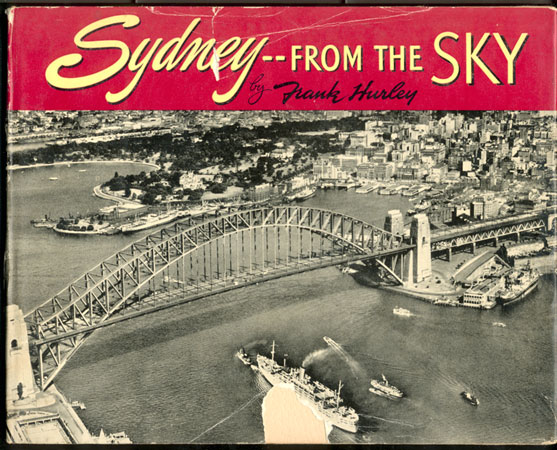
a photo-web presention
of one of Frank Hurley's books |
|
 |
|
| |
|
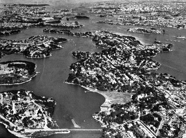 |
Sydney Harbour, named Port Jackson by Captain Cook in 1770, was explored by Captain Phillip eighteen years later (see Foreword concerning its formation).
Total area is 13,614 acres, of which 3000 acres have a depth ranging between 35 and 160 feet.
The length of foreshore is 183 miles. The average range of tides is 4 feet 4 inches. |
| |
|
 |
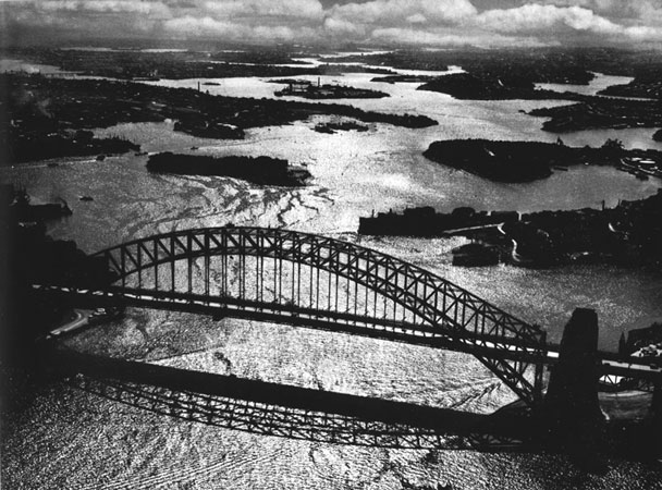
Sydney Harbour Bridge and Circular Quay. The bridge is the longest arch-bridge in the world.
The length of the central span is 1650 feet, and the whole structure contains 52,300 tons of steel.
The bridge carries four lines of electric-railway track, a six-lane roadway, and two footpaths each 10 feet wide. |
| |
|
 |
Circular Quay (Sydney Cove), Australia’s most historic spot.
Governor Phillip and men of the First Fleet stepped ashore here on 26th January 1788.
Circular Quay is now a harbour ferry terminal through which 31,000,000 passengers pass each year. |
| |
|
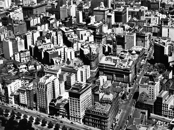 |
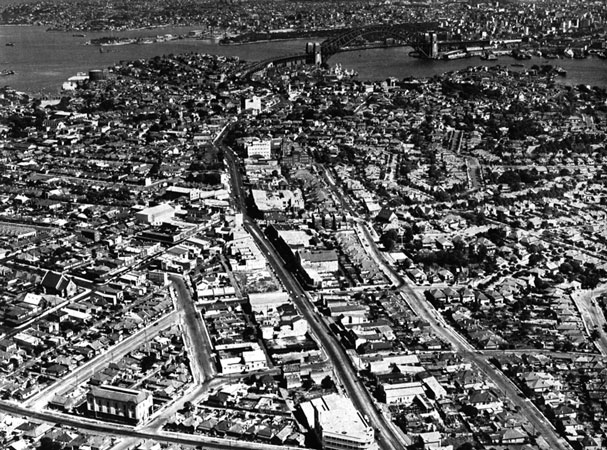
Junction of Macquarie and Bridge streets.
The road system of Sydney has changed little since the early days of settlement.
The roads, originally designed for horse-drawn vehicles, now have to cope with the heavy demands of modern traffic. |
| |
|
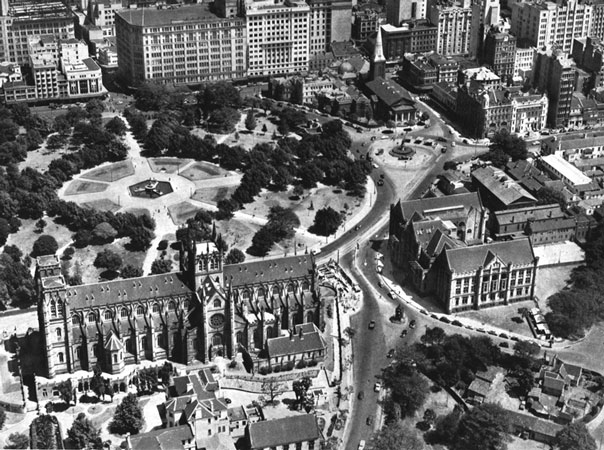 |
Eastern approach to the city. St Mary’s Basilica is in the foreground, and beyond is the Archibald memorial fountain.
Centre right are Queen’s Square and the historic St James’s Church. |
| |
|
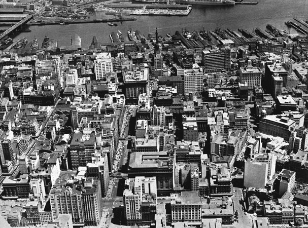 |
Martin Place and the heart of Sydney.
The General Post Office is at centre left.
This area is the financial centre of the city Martin Place was named after Sir James Martin, Chief Justice of New South Wales in 1873.
In the background are the wharves of Darling Harbour. |
| |
|
 |
The city from Walsh Bay, looking south towards Botany Bay.
Miller’s Point and Observatory Hill in the foreground are associated with the early settlement. |
| |
|
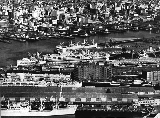 |
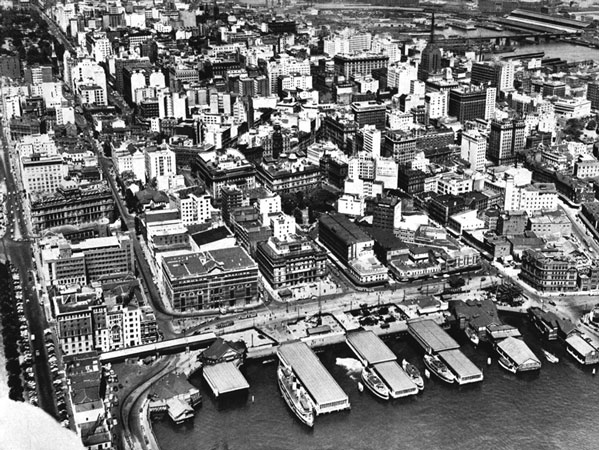
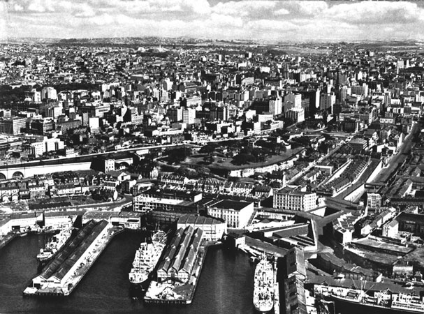
Looking across Darling Harbour from Pyrmont wharves to the metropolis.
Wharves are from 500 to 1240 feet in length, the depth of water ranging up to 41 feet.
If all commercial wharves were joined together their total length would be 14 miles. |
| |
|
 |
Looking over North Sydney from St Leonards to the city.
The Pacific Highway leads through to the Bridge. Crow’s Nest is in the centre. |
| |
|
 |
Lindfield, a typical example of the beautiful North Shore suburbs renowned for lovely garden homes and tree-lined streets |
| |
|
 |
From Neutral Bay looking east across Kurraba Point, Cremorne, Mosman, and Bradley’s Head.
In the distance are Vaucluse, Watson’s Bay, and Inner South Head. |
| |
|
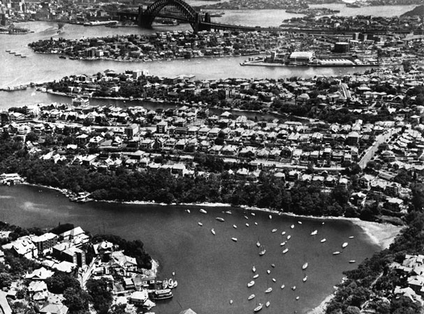 |
A Sydney Harbour foreshore where every home boasts a glorious view. Mosman, Cremorne, Kirribilli, and the Bridge.
The deepest part of the harbour is just beyond the Bridge. |
| |
|
 |
Cremorne and Mosman.
At top right the Corso at Manly is clearly visible. Mosman derives its name from an early settler, Archibald Mosman, who in 1831 was given a grant of four acres to found a whaling station.
Part of the original buildings is used today by Boy Scouts. |
| |
|
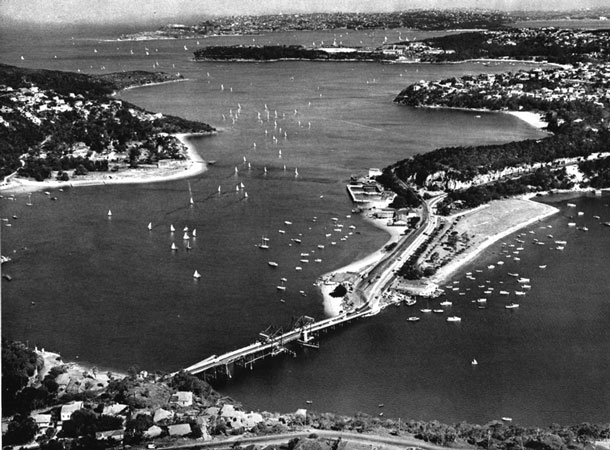 |
From Seaforth looking over the Spit down Middle Harbour to South Head.
The scene during a regatta, when the blue waters are a-flutter with sailing craft, is one never to be forgotten—probably the finest of all harbour scenes. |
| |
|
 |
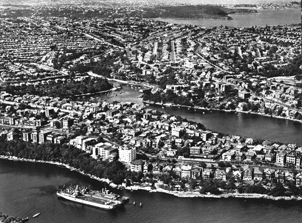
Balmoral, another of Sydney’s “dress-circle” suburbs.
From almost every home built on the rising slopes, fine views are obtained of the esplanade, beaches, and Middle Harbour waters. |
| |
|
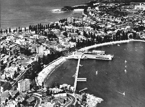 |
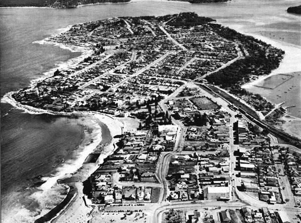
The Corso, Manly, seven miles by ferry from the city.
The natural charm of this suburb with its harbour coves and grand ocean beaches has been added to by welt-planned amenities.
Governor Phillip discovered the place in 1788, and the manly bearing of the natives he found there so impressed him that he called it “Manly”, a name now world famous. |
| |
|
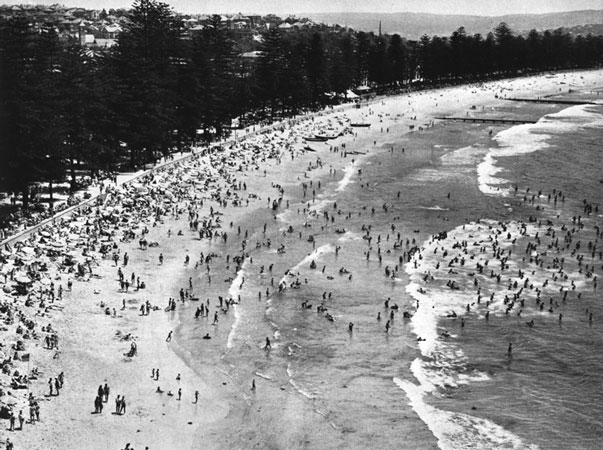 |
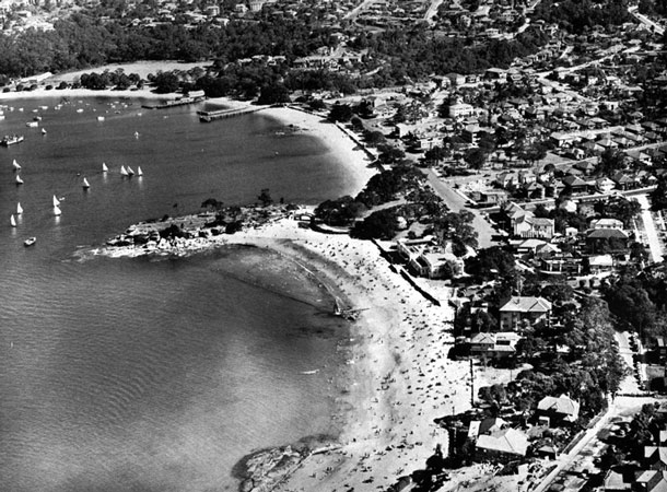
South Steyne, Manly’s deservedly popular surfing beach.
An attractive feature of Manly’s ocean beach is the promenade, shaded by a fine avenue of Norfolk Island pines. |
| |
|
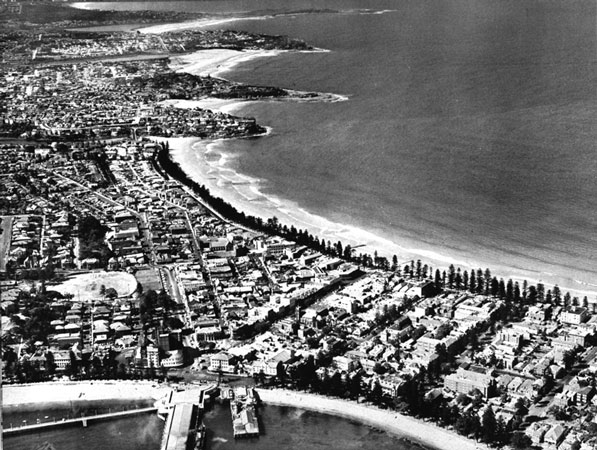 |
This photograph gives a comprehensive view of the Corso, Manly, the ocean beach, and the beaches that extend northwards to Narrabeen.
Each beach has its surf life-saving club, whose members give voluntary service and save hundreds of lives annually. |
| |
|
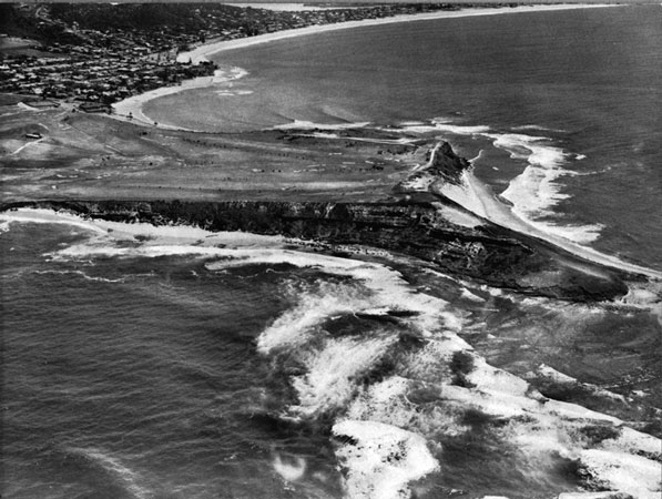 |
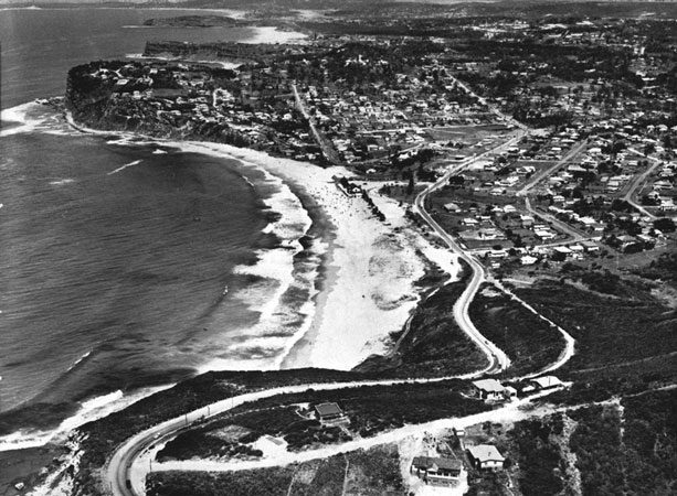
The Long Reef golf links, looking towards Collaroy. |
| |
|
 |
Narrabeen and its lagoon was discovered by Governor Phillip in 1788.
Good fishing, boating, camping, and surfing are its attractions.
The National Fitness Camp is at the head of the arm, top right. |
| |
|
 |
Newport from above Reservoir Hill, looking towards Mona Vale.
To the right lies Pittwater (see next picture). |
| |
|
 |
The head of Pittwater.
Newport is at left and Bayview at extreme right.
Mona Vale ocean beach is in the background.
Pittwater is popular with boating and fishing enthusiasts.
It was named by Phillip after Britain’s famous Prime Minister, Pitt the Younger. |
| |
|
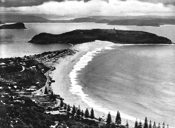 |
Palm Beach is 27 miles by bus from Sydney; its remoteness helps to make it one of the more exclusive beaches.
In addition to a surfing beach it has a smooth-water foreshore. Broken Bay, which rivals Sydney Harbour for scenery, extends westwards.
The headland is known as Barrenjoey. |
| |
|
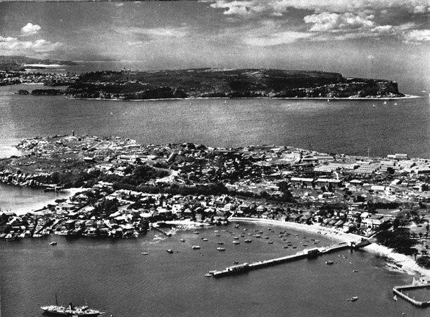 |
Entrance to Sydney Harbour, looking from Watson’s Bay across Inner South Head to North Head.
Captain Cook named the harbour Port Jackson in 1770, but took it to be a small inlet and did not examine it.
The distance between the Heads is 1650 yards, and the depth of water in the channel is 140 feet; nowhere is it less than 75 feet deep. |
| |
|
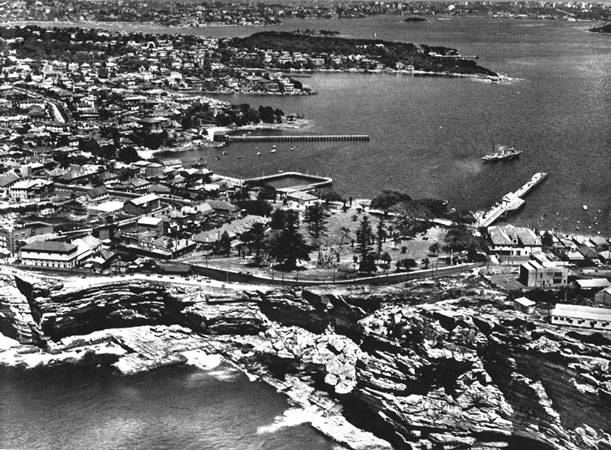 |
Looking up Sydney Harbour from above the Gap at Watson’s Bay.
Near this spot the ship Dunbar was wrecked in 1857, with a loss of 121 lives. |
| |
|
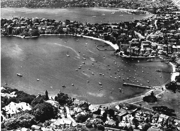 |
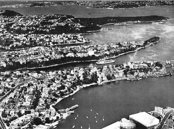
Double Bay, looking towards Rose Bay and Vaucluse.
Rose Bay is the terminal of flying-boat services. |
| |
|
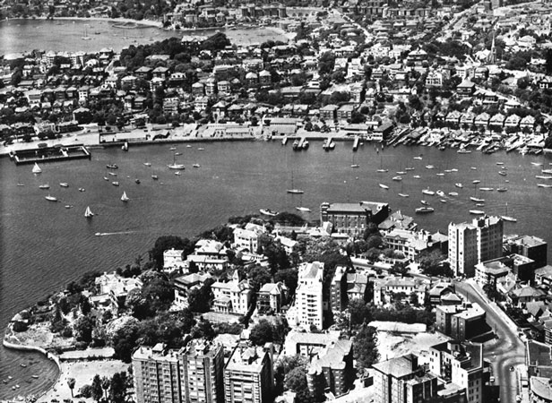 |
Rushcutter’s Bay from Macleay Point. Darling Point is at left and Double Bay beyond.
This area is one of fine homes and flat buildings, and it is also an anchorage for pleasure craft.
|
| |
|
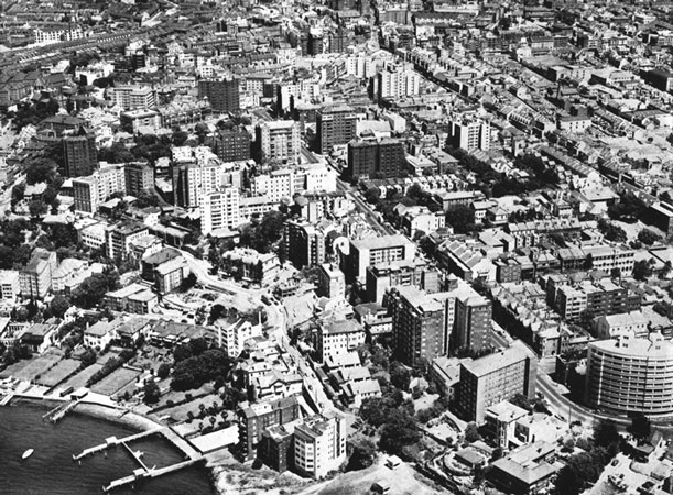 |
Potts Point, cosmopolitan centre of Sydney’s flat life. Macleay Street traversing the picture runs on to King’s Cross.
The area is to Sydney what Soho is to London. |
| |
|
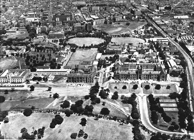 |
The University of Sydney, with its colleges and playing fields.
Prince Alfred Hospital and the King George V Memorial Hospital are the blocks of buildings at top left. |
| |
|
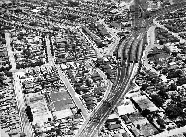 |
Strathfleld, one of Sydney’s oldest suburbs. It is renowned for its beautiful old homes and well-established avenues.
It is also an important railway junction.
|
| |
|
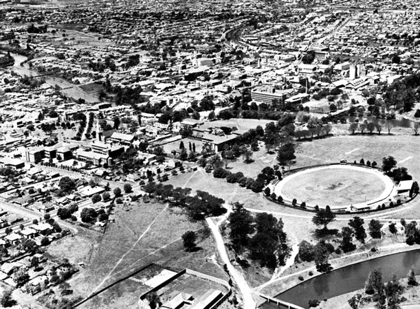 |
The city of Parramatta. Apart from Sydney, Parramatta is the oldest town in the Commonwealth. Governor Phillip chose the site as the colony’s first inland town, and building commenced there in 1788.
At that time it was called Rose Hill, but the present aboriginal name was given two years later; it means, “head of the river”.
Today Parramatta is a flourishing town of fine buildings, wide streets, and beautiful parklands. |
| |
|
 |
Looking down the Parramatta River from Gladesville.
The suburb of Drummoyne is at right; Cockatoo Island is above; and the important shipbuilding yards and docks at Woolwich to the left. |
| |
|
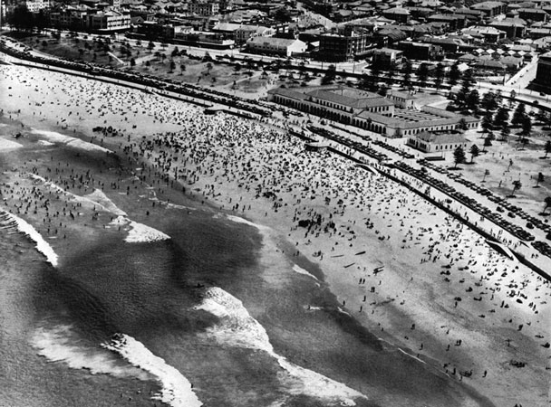 |
Bondi Beach is, so to speak, the city’s doorstep.
Easily reached by tram and bus, it is a popular and densely settled area.
The name originated with the Kamilroi—the Port Jackson natives—who referred to it as Boondi, meaning, “water breaking over rocks”. |
| |
|
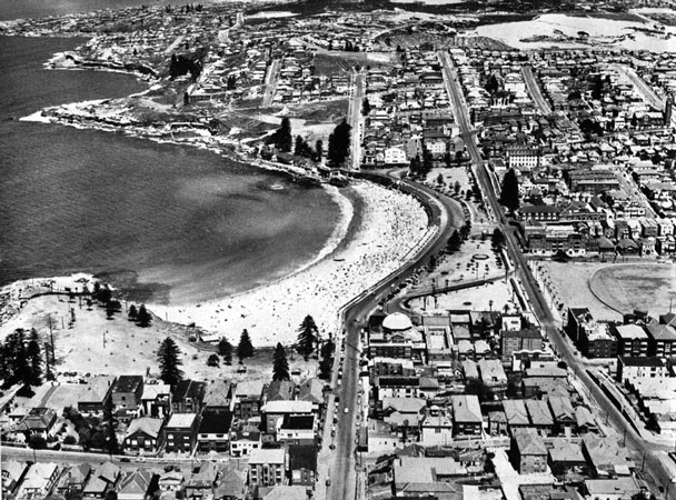 |
Coogee is another well-favoured beach, and is mentioned as far back as 1834 as a resort popular with settlers.
Good surfing, swimming pools, reserves, and seaside walks are its attractions. |
| |
|
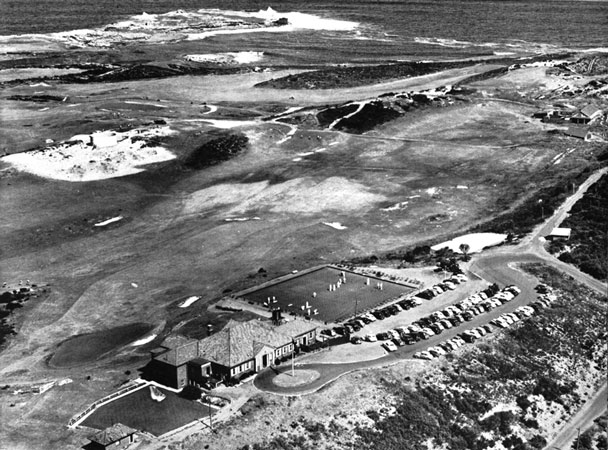 |
The New South Wales Golf Club course at La Perouse, situated on the undulating slopes of Cape Banks overlooking the sea and the broad expanses of Botany Bay.
The course with its fine club house is considered to be one of the finest in the State. |
| |
|
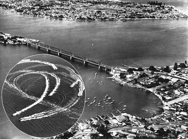 |
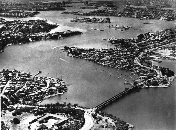
Looking from Sylvania across George’s River to Kogarah Bay and Sans Souci.
Tom Ugly’s Point is at left of the bridge.
Inset shows boats of the St George Motor Boat Club in action. |
| |
|
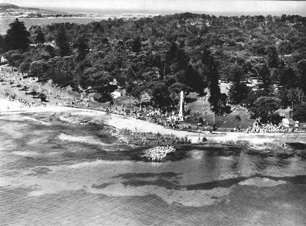 |
The monument that marks the landing place of Captain Cook at Kurnell, Botany Bay. Extract from Captain Cook’s journal: “Saturday 28th April, AD. 1770.
At daybreak we discovered a bay, and anchored under the South shore, about two miles within the entrance, in six fathoms of water.” |
| |
|
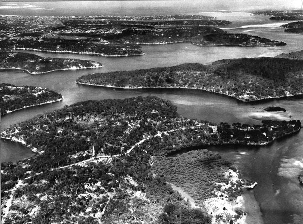 |
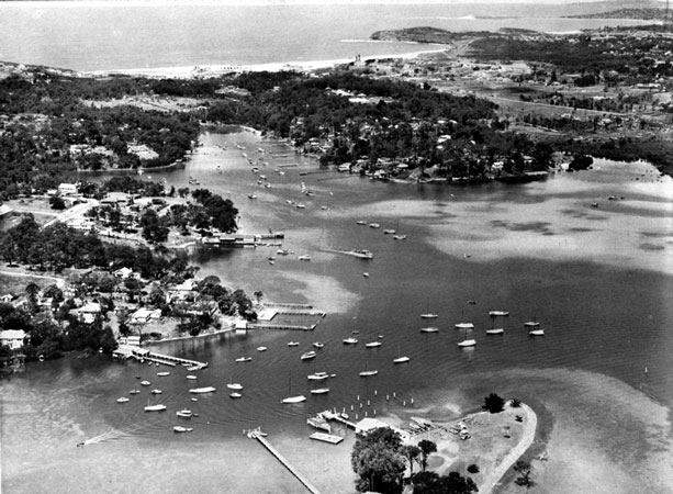
Port Hacking, unspoilt as yet by closer settlement, is Sydney’s most southern inlet.
Discovered by Bass and Flinders in 1796, the estuary was named after the pilot, Henry Hacking.
The picture was taken above Gray’s Point.
Gundamain is at the end of the point in the right foreground. |
| |
|
 |
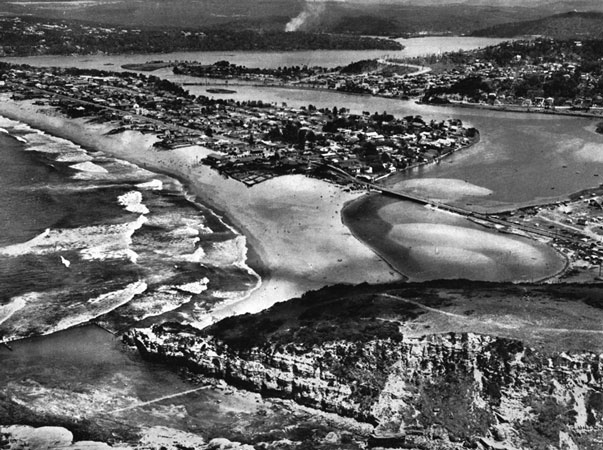
Looking from Gunnamatta Bay across Cronulla isthmus to the beach and sandhills.
In the far distance can be seen Kurnell, Captain Cook’s landing place. |
| |
|
 |
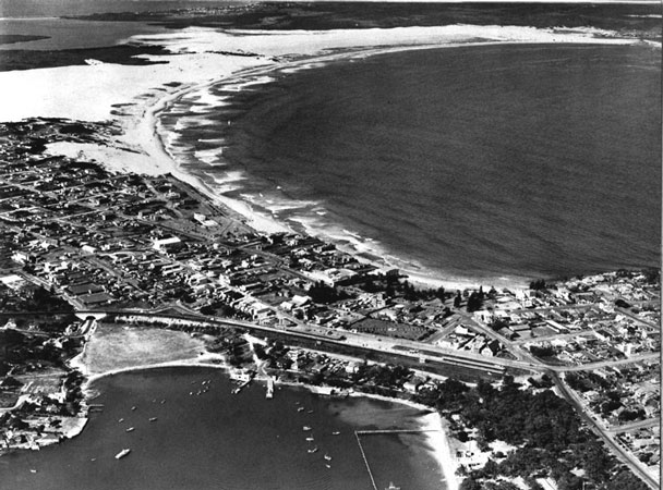
Cronulla peninsula and the entrance to Port Hacking.
A fast electric-train service has helped to bring about the rapid development of this suburb as a residential area.
It is popular because of its surfing beaches and its fishing and boating attractions. |
| |
|
 |
The afternoon sun transmutes the blue waters of a hundred inlets to an enchanted haven of sparkling silver. |
| |
|
 |
Back Cover |
| |
|